
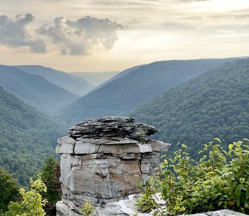
The Blackwater Canyon
At more than 10,000 acres the blackwater canyon is home to many natural resources, diverse creatures and a rich history.
The River
The entire river is 31 miles long.
This river drains an area of 142 square miles.
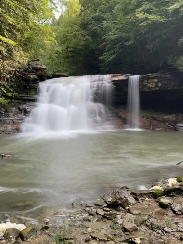
Blackwater Falls is the location at which the river starts picking up speed and cutting into the rock to form the canyon.
The canyon section of the river drops over 1,500 feet in elevation over just ten miles!
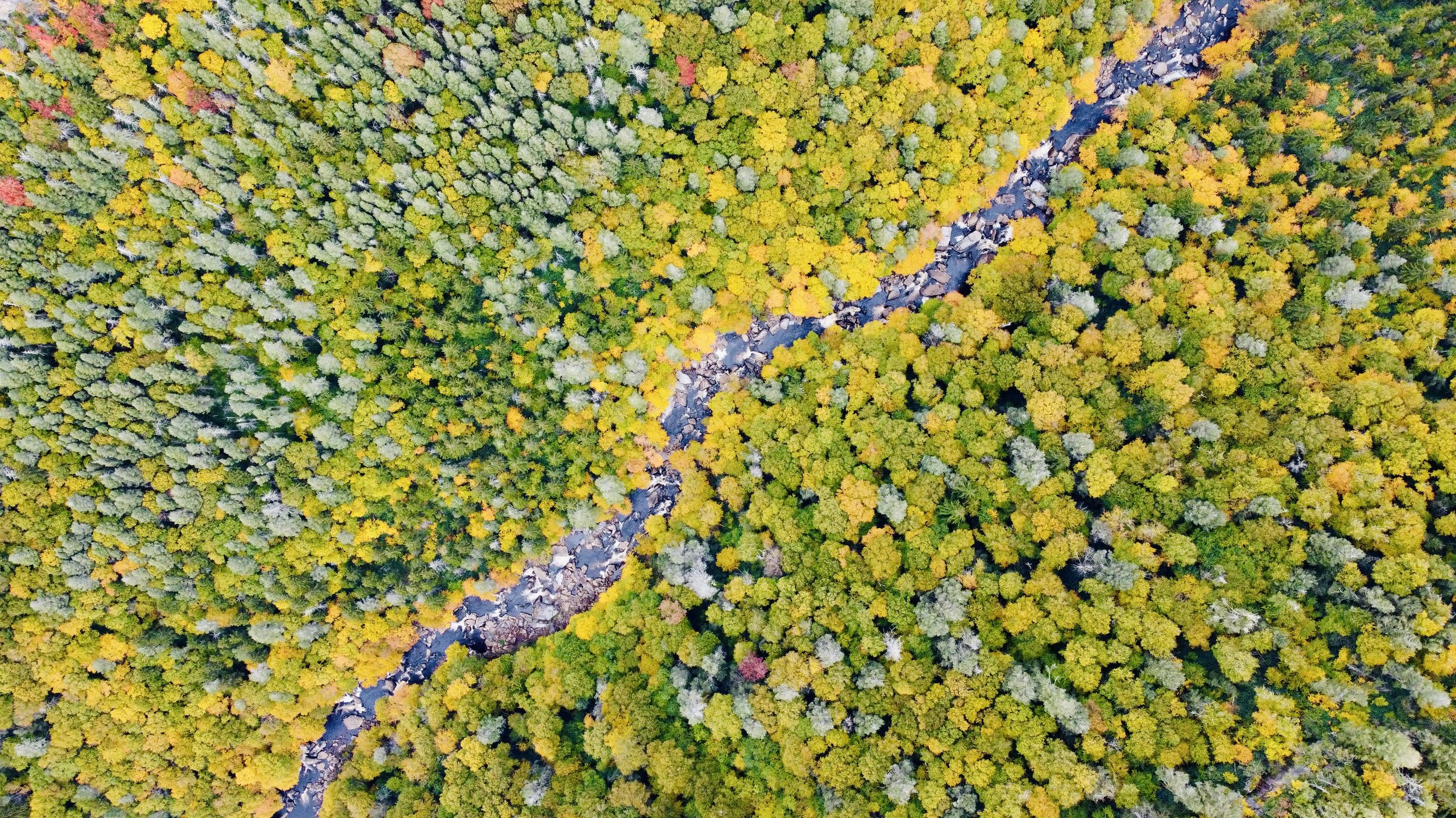
The term "Blackwater" refers to the tea-like color of the water caused by the tannins released from the hemlock and red spruce trees growing in the canyon.
Geology
The water that ultimately ends up in the Blackwater River originates from high elevation areas (i.e. Dolly Sods Wilderness) to the east. Water flowing off of the western slope of the Allegheny Front collects in the Canaan Valley wetlands. This water meanders its way through multiple types of wetlands such as peat bogs, marshes, and fens. Eventually, it starts to form the Blackwater River, which flows gently through the landscape until it reaches Blackwater Falls, where it picks up speed and drops 1500 feet over the next ten miles. This drop in elevation and increase in flow is what formed the Blackwater Canyon, creating a section of rapids and cascades (view footage here) that only the gnarliest of kayakers would dream of running.

Recreation
People find many ways to recreate in the Blackwater Canyon. Visiting places like Blackwater Falls State Park, Canaan Valley State Park, Timberline Mountain Resort, and Dolly Sods Wilderness will present unlimited opportunities to try out some:
White Water Kayaking
Mountain Biking
Fly Fishing
Hiking
Backpacking
Wildlife/Plant Viewing
Camping
Downhill Skiing/Snowboarding
Cross-Country Skiing
Snowshoeing.

First Explorations
The first expedition into the Blackwater Canyon Watershed took place in 1736; a survey organized by Thomas Lord Fairfax to ascertain the land that he inherited from his parents. This included all the land between the Potomac and Rappahannock rivers. They ventured into the unknown lands of the Canaan Valley and marked the first fountain of the Potomac. Ten years later in 1746, a party led an expedition to place the Fairfax Stone, marking the headwaters of the Potomac under the name of Lord Fairfax. It was not until much later that these lands were traversed in the name of adventure. The first explorers to do so being Philip "Pent" Pendleton Kennedy and his group in 1851. Among them was David Hunter Strother, the illustrator of the Blackwater Chronicle, an account of this expedition by Kennedy. The party never made it to Blackwater Falls during their first expedition; they thought they had found it when they arrived at Douglas Falls along the North Fork Blackwater River in present day Thomas, WV. In the narrative, tales are told of impenetrable laurel thickets, deer so tame they could almost be touched, and trout so abundant one couldn't keep a line in the water for more than an instant. Contained in this section are some of the illustrations done by Strother, under the pen name Porte Crayon.
Native Americans
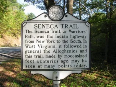
Tucker County, WV, was mainly used as a hunting ground and travel route by Native Americans. There is, however, some evidence of Native American settlement in the county, though it is pretty apparent that there were no Native American settlements in the actual Blackwater Canyon. On the topic of travel, Tucker County is home to a section of the Seneca Trail. This trail stretched over 500 miles from Niagara Falls to the Gulf of Mexico and was used as a military road by the Iroquois Nation. The Iroquois Nation consisted of the Mohawk, Oneida, Onondaga, Tuscarora, Cayuga, and Seneca Tribes; they dominated the land between the Appalachians and the Mississippi River. When the trail arrives at the modern location of Pittsburg, PA, it ascends the Youghiogheny River to it's source at Maple run in WV. From there it goes to the North Branch of Wolf Run near Shaffertown. Then it crosses the Cheat River at Horseshoe Bend and crosses over Pheasant Mountain into Randolph County, WV. Most of the Seneca trail has been destroyed or built over by now, leaving only sections of this once great trail scattered throughout the Appalachians. There is a burial mound located at Horseshoe Bend on the Cheat River that measures 40 feet wide by 5 feet tall. Woodchucks have been documented uncovering Native American bone fragments from the mound. The Native Americans that formerly occupied Tucker County were the Massawomee Tribe of the Iroquois Nation.
Thompson, Kathleen, Justin Adkins, and Clio Admin. "Seneca Trail Historical Marker ." Clio: Your Guide to History. September 3, 2020. Accessed January 3, 2022. https://theclio.com/entry/4694